

The first time I ran the Garmin Striker 4 on my jon boat, the screen showed a flat line at six feet and nothing else. I spent twenty minutes poking at the buttons before I worked out that I had the transducer tilted an inch too high, running in clean bubbles instead of water. Dropped it the rest of the way under the surface and the whole lake opened up. Bottom at fourteen feet, a hard break where the flat falls off into the old channel, and a cloud of something suspended at eleven feet that turned out to be a school of crappie holding tight to a brush pile I did not know was there.
That was the middle of April. The Striker 4 has been on the boat on every trip since. Spring bass on the small lakes west of Kalamazoo, a summer of bluegill and crappie with my grandson Tyler, and the cold mornings I spend working the South Haven piers before the wind comes up. I am not a tournament angler and I am not going to pretend to be one. What I am is a retired machinist with a fourteen-foot aluminum boat, a small trolling motor, and a full season of notes written on the back of a tackle receipt. Here is the honest version, including the parts that still get on my nerves.
The Quick Verdict
Three and a half inches of screen that shows depth, shows fish, and marks your spots. Nothing fancy on it. It has not let me down yet, and most of what annoys me is the sort of thing a much bigger unit would fix.
Amazon Check Today's Price →The one piece of electronics that stayed on my boat all season
The Striker 4 comes with the head unit, the transducer, the power and data cable, the tilt and swivel mount, and the transom hardware. Nothing else to chase down before your next trip.
Amazon Check Today's Price on Amazon →How I've Used It
The box held the head unit, the transducer, the power and data cable, the tilt and swivel mount, and the transom mounting hardware. I bolted the transducer bracket to the transom of the jon boat, ran the cable up the inside of the hull alongside the trolling motor wiring, and set the head unit on the swivel mount where I could see it from the middle bench without turning my head. The whole job took one afternoon, and most of that afternoon went into finding the right drill bit and then finding it again after I set it down.
The unit is battery powered, so it runs off the same battery I already carry for the trolling motor. It weighs eight ounces, which is about what a paperback weighs. Over a six hour trip I have not noticed it pulling the battery down in any way I could measure, and I never ran a separate power line for it. Because it is small and light, I pull it off the swivel mount and lock it in the truck cab at the ramp. That is a habit I would not have with something wired in permanently.
A normal trip goes like this. Push the power button, give the sonar a few seconds to settle, and drop the transducer under the surface once the boat is off the trailer. The keyed interface has dedicated buttons rather than a menu tree, so I am not hunting through screens with wet hands and one eye on the boat. One button takes me to the sonar page, another goes to the map, and the arrows move me between readings. By the third trip my thumb knew where everything was without me looking down.
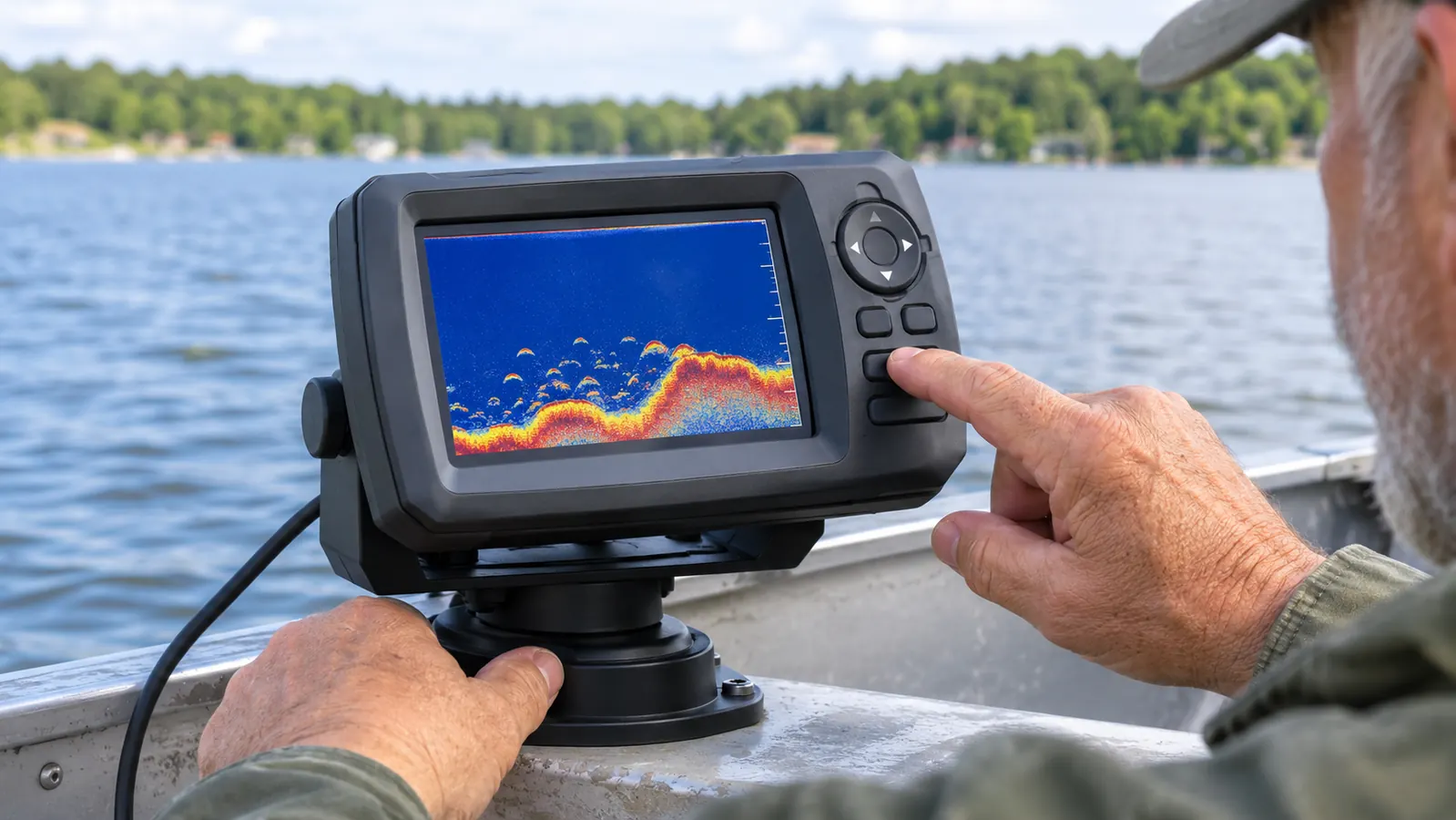
The Screen Is Small, and On a Jon Boat That Is the Point
The display is three and a half inches on the diagonal, with a viewing area of roughly 1.9 by 2.9 inches. That is close to the size of the backup screen in an older truck. On a jon boat, where the unit sits on a swivel mount maybe two feet from my knee, it is plenty. I can read the depth number from the middle bench without leaning forward, and I can see a fish arch come up off the bottom while I am watching my line instead of the screen.
What it is not plenty for is a split screen in bright sun. Run the sonar on one half and the map on the other and each pane gets small enough that I have to squint and lean. I stopped splitting it. Sonar while I am fishing, map while I am idling back to a spot. That is a habit the screen forced on me, and after a season I think it is the better habit anyway, because I pay more attention to the water when the screen is only telling me one thing.
Glare is the other issue. Late morning with the sun coming off the water, an LCD like this one washes out unless I angle the swivel mount down a few degrees. The mount handles that fine and I have never lost the depth reading entirely, even on the brightest days in July. But if you are the sort of person who wants to study a screen for ten minutes at a stretch, three and a half inches will feel like looking through a peephole.
What CHIRP and ClearVü Actually Put On the Screen
The Striker 4 runs CHIRP sonar, which sweeps across a range of frequencies instead of firing on one, and ClearVü scanning sonar, which is the higher frequency look at what is directly under and around the boat. In plain terms, the traditional CHIRP view gives me a clean bottom line with a hard return I can trust, and the arches that separate a fish sitting off the bottom from a stick sitting off the bottom. On a lake where the difference between a limit of crappie and a long quiet afternoon is a few feet of water, that matters.
ClearVü is the view I use over structure. There is a brush pile on a lake west of Kalamazoo that I found the hard way by dragging a jig through it and losing two jigs. ClearVü drew it as a lumpy dark mass slightly off to one side of the boat, with the individual branches showing up as thin streaks coming off the main pile. I have never seen that on a unit that only runs traditional sonar. It is not a photograph and it takes a few passes to learn what you are looking at, but once your eye adjusts it is the most useful thing on the screen.
Garmin rates the maximum measuring depth at 1,600 feet. I have never fished water anywhere near that deep and neither has anyone I know in this part of Michigan. The deepest inland lake I fish bottoms out around sixty feet. What that rating tells me is that depth is not the thing that will ever limit this unit. What limits it is how well the transducer is mounted and how much screen I have to look at, and both of those are things I can manage.
The Waypoint Map Earned Its Keep in July
The waypoint map is a plain plotter. You mark a location, it shows as a point on a grid, and it will navigate you back to it. There are no contour lines and no lake charts built into it, so do not buy this expecting a depth map of your lake. What there is, is a way to turn a good spot into a number instead of a story about the oak tree on the left bank that looked different the last time you were out.
In July I found a stump field on a lake I had fished for twenty years without knowing it existed. I marked the outside edge of it, marked the deep side where the bottom fell away, and marked the one stump that produced three keepers in under an hour. Two weeks later I followed the map back to that third mark and put a jig on that stump on my first cast. Twenty years on that water and I had been finding it by luck every single time.
The map page is also what made me stop carrying a handheld GPS in the boat bag. One unit, one screen, one set of marks that I will actually remember to save. I have about thirty waypoints in there now, with names like STUMPS and PIPE and the one Tyler labeled TYLERS SPOT in all capitals because he wanted to be sure I would not overwrite it.
Where It Comes Up Short
The screen is the first limitation and I have already been through it. The second is that everything on this unit is basic on purpose. No lake map card, no side imaging, no networking to anything else. You get sonar, a plotter, and depth and temperature readings. That is the entire feature list, and it is worth being clear about that before you order one and start looking for the rest of it.
The third is the warranty. It is one year, limited. For electronics that live in a wet boat and get rained on more than once, that is short, and it is the kind of thing nobody thinks about until month fourteen. I have had no trouble with mine, but I take it off the boat and put it in the truck cab between trips partly for that reason and partly because I do not want to buy another one.
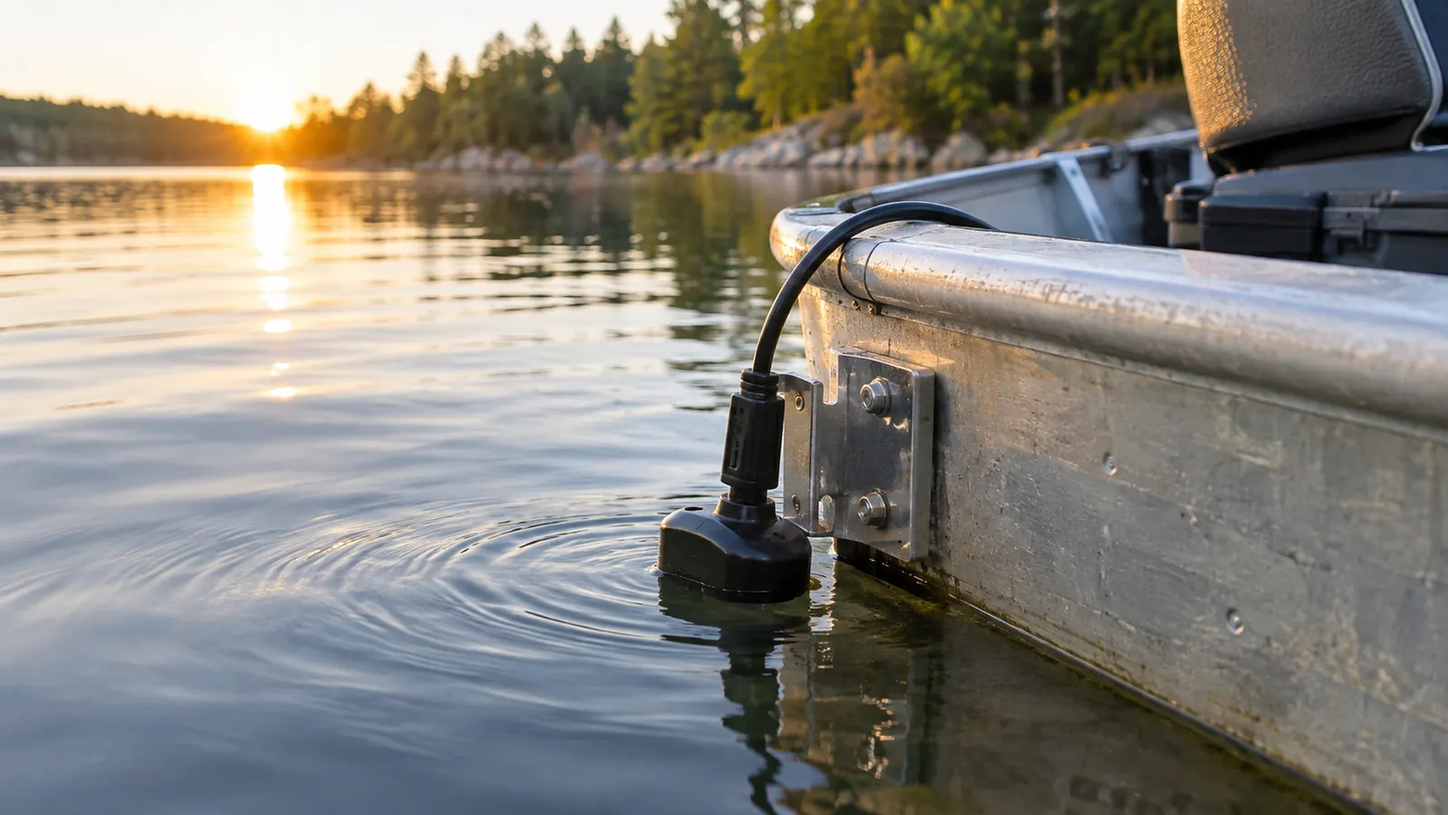
And the fourth is the transducer install. Mine reads well because I spent the time getting the bracket height right, and I still got it wrong on the first attempt. Bolt it on at whatever angle looks reasonable and walk away, and you will get a flat line at speed and blame the sonar. Read the mounting instructions twice and test it before you leave the ramp. That is not a knock on Garmin. It is a knock on how these things get installed in a driveway on a Saturday morning.
What I Liked
- Clean bottom readings and readable fish arches from the CHIRP sonar, even in shallow inland water
- ClearVü scanning sonar shows brush, stumps and rock in a way traditional sonar does not
- Keyed interface with dedicated buttons, easy to run with wet hands in a small boat
- Eight ounces on a swivel mount, so it comes off at the ramp and rides in the truck
- Waypoint map marks a spot precisely instead of lining up bank landmarks
- Runs off the boat battery with no draw I could notice across a six hour trip
Where It Falls Short
- Three and a half inch screen washes out in direct sun unless you angle the mount down
- Split screen is too cramped to be worth using
- No lake charts or contour maps built in, waypoints only
- One year limited warranty is short for something that lives in a wet boat
- Transducer mounting height is fussy and easy to get wrong the first time
Twenty years on that lake and I had been finding the stump field by luck. One afternoon with the Striker 4 turned it into three numbers on a map.
Who This Is For
If you fish from a small boat, a canoe, a kayak or a dock, and you have been fishing the same water by feel and by memory, this is the unit that changes that for not much commitment. It suits the angler who wants three things done well: depth, fish, and a way back to a spot. It suits a jon boat with a trolling motor and a battery, because that is the entire install. It suits someone like me, who retired and finally decided to learn the lakes he had been guessing at for thirty years. Tyler, who is twelve and reads screens faster than I do, had the sonar page figured out before we left the dock the first time.
Who Should Skip It
Skip it if you fish big water and need to hold a bottom reading at thirty miles an hour, because a three and a half inch screen and a transom transducer are not built for that and no amount of adjusting will make them. Skip it if you want contour maps of your home lake on the screen, because this unit does not carry them and nothing in the settings will add them. Skip it if you already run a larger Garmin or a competitor's unit with side imaging, since this would be a step backward. And skip it if you are not willing to spend an afternoon getting the transducer mounted properly, because a badly mounted transducer makes any sonar on the market look broken.
A full season on the water and it is still the first thing I switch on
Sonar, a waypoint map, a mount that comes off in ten seconds, and a battery lead that goes to the battery you already have. If that covers how you fish, this covers it well.
Amazon Check Today's Price on Amazon →